09/27/2022 5 PM Update
Posted on September 27, 2022 - 6:5 PM
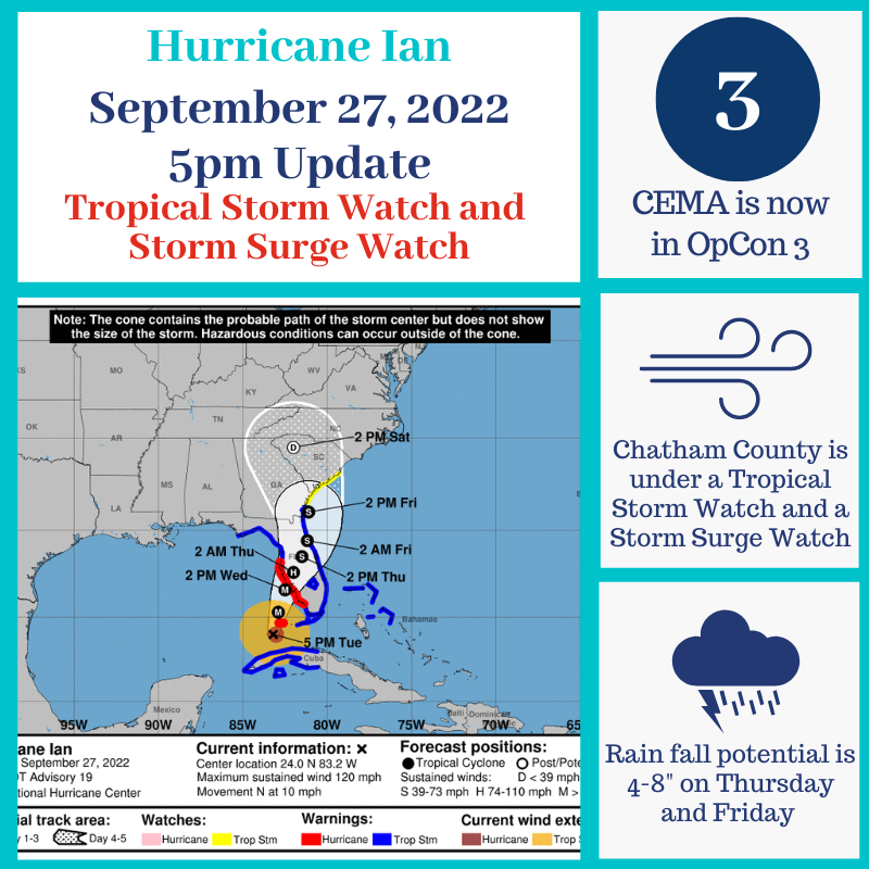
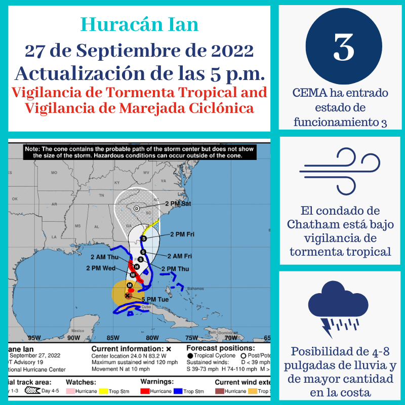
CEMA remains in OPCON 3, the Watch/Warning Phase, as Hurricane Ian continues its approach to the Florida coast. Chatham County is under a Tropical Storm Watch and a Storm Surge Watch. Hurricane Ian has sustained winds at 120 mph and is moving N at 10 mph. Sustained winds are approximately 410 miles south of Chatham County. Ian is a Category 3 hurricane. The path and intensity of the storm remains uncertain. Potential impacts to our area are expected Thursday and Friday and include Tropical Storm force wind gusts, potential isolated tornadoes, 4-8” of rainfall, and coastal flooding due to elevated tides and possible storm surge.
If you have not done so, you can sign up for CEMA Alerts at chathamemergency.org or text CEMA to 77295 to receive up to date information as it becomes available.
This is the time to review your personal emergency plans and replenishing and/or creating emergency kits. To find out what you need in your kit visit ready.chathamcountyga.gov and look under the Hurricane Ian tab.