09/30/2022 Hurricane Ian Late Morning Update
Posted on September 30, 2022 - 12:7 PM
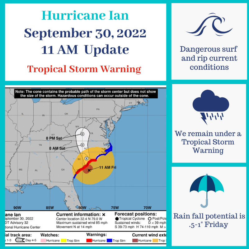
Ian remains a Category 1 Hurricane. Chatham County remains under a Tropical Storm Warning. Chatham County no longer under a Flood Watch. Hurricane Ian has sustained winds at 85 mph and is moving N at 14 mph.
Potential impacts remain consistent for our area Friday morning into afternoon, which include:
-tropical storm conditions are occurring
-.5” - 1” of rainfall
-possible life-threatening surf and rip current conditions
If you have any questions or concerns, don’t hesitate to contact CEMA at 912-201-4500.
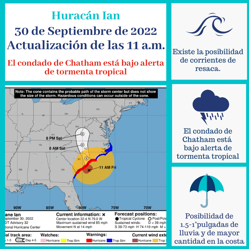
Hurricane Ian - September 30th 5AM update
Posted on September 30, 2022 - 5:18 AM
Ian remains a Category 1 Hurricane. Chatham County remains under a Tropical Storm Warning and a Storm Surge Warning. A Flood Watch is in effect east of I-95 until Saturday morning, October 1. Hurricane Ian has sustained winds at 85 mph and is moving NNE at 9 mph.
Potential impacts remain consistent for our area Friday morning into afternoon, which include:
-gusty winds that are potentially Tropical Storm strength
-.5” - 1” of rainfall
-elevated tides, especially around Noon Friday
-possible life-threatening surf and rip current conditions
-storm surge of 3-5 feet
Tropical-storm-force winds extend outward up to 415 miles from the center of Ian. The combination of storm surge and the tide will cause normally dry areas near the coast to be flooded by rising waters moving inland from the shoreline.
If you have any questions or concerns, don’t hesitate to contact CEMA at 912-201-4500.
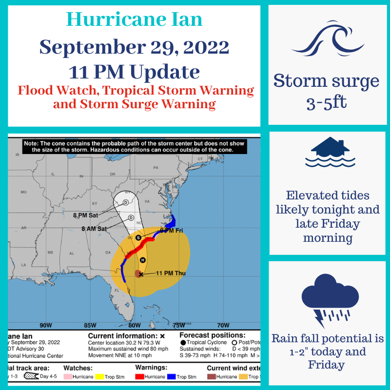
Hurricane Ian - September 29th 11pm update
Posted on September 29, 2022 - 11:50 PM
Ian remains a Category 1 Hurricane. Chatham County remains under a Tropical Storm Warning and a Storm Surge Warning. A Flood Watch is in effect until Saturday morning, October 1. Hurricane Ian has sustained winds at 80 mph and is moving NNE at 10 mph.
Potential impacts remain consistent for our area late this evening into Friday afternoon, which include:
-gusty winds that are potentially Tropical Storm strength
-1-2” of rainfall
-elevated tides, especially around Noon Friday
-possible life-threatening surf and rip current conditions
-storm surge of 3-5 feet
Tropical-storm-force winds extend outward up to 415 miles from the center of Ian. The combination of storm surge and the tide will cause normally dry areas near the coast to be flooded by rising waters moving inland from the shoreline.
If you have any questions or concerns, don’t hesitate to contact CEMA at 912-201-4500.